Author: Jan

  • Driving in Patagonia (2026 Guide)

    Driving in Patagonia (2026 Guide)

    I thought I was prepared.

    Before you go: install a reliable eSIM for Patagonia’s remote areas so you have maps and messaging when cell signal drops.

    After driving thousands of miles in Chile, I assumed driving in Patagonia would just be “more of the same”. Long roads. Beautiful landscapes. A few potholes. Nothing dramatic.

    I was wrong.

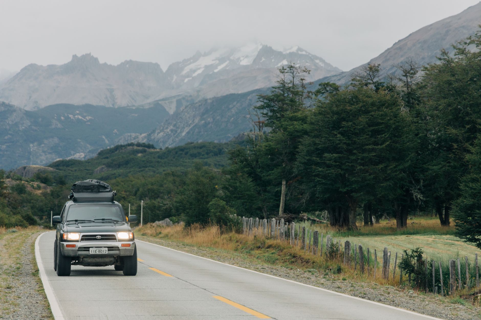
    Driving in Patagonia is not just driving. It is isolation. It is wind that moves your car sideways. It is gravel roads that stretch for hours. It is gas stations that simply do not exist when you expect them.

    And that is exactly why it is unforgettable.

    This is not city driving. Not even close. There are days when you barely see another car. There are stretches where the only thing around you is sky, mountains, and endless emptiness.

    In this guide, I share everything I learned about driving in Patagonia. The surprises, the mistakes, the things that look easy on a map but are not, and what I would absolutely do differently next time.

    This is not a rulebook. It is real experience, from behind the wheel at the end of the world.

    Some basics

    • You drive on the right
    • There are potholes, even on roads that look perfectly fine
    • Bring enough cash for tolls, it adds up quickly
    • Waze is the most used navigation app, not Google Maps, and it shows speed cameras
    • Animals can walk freely on the road, including dogs, sheep, and horses

    What else to know

    • Patagonia is bigger than you think, and it does not care about your schedule
    • The wind can physically move your car across the lane
    • Gas stations are not guaranteed, even when the map says there is a town
    • A paved road can turn into gravel without warning
    • There are stretches where you are completely alone

    Still need to rent a car?

    If you are flying into southern Patagonia, Puerto Natales is one of the easiest places to pick up a rental car. It is the main gateway to Torres del Paine and the surrounding region, and most major routes start from here.

    Renting in Puerto Natales gives you immediate freedom. You can drive straight to Torres del Paine, explore lesser known viewpoints, or plan multi day routes without depending on bus schedules or tours.

    One important thing to check before booking:

    • Is gravel road damage covered?
    • Does the car include a spare tire?
    • Are border crossings to Argentina allowed?
    • How are tolls or park fees handled?
    • Is pickup at the airport or in town?

    RENT A CAR HERE:

    In Patagonia, the car matters more than in cities. Higher ground clearance is often more useful than a flashy vehicle. Reliability beats comfort.

    DiscoverCars is a practical place to compare rental companies in Puerto Natales. You can see real reviews, filter by insurance coverage, and check which vehicles are actually available for your dates.

    If you want flexibility and the ability to stop whenever the landscape pulls you over, renting a car in Puerto Natales is the best way to experience Patagonia on your own terms.

    Things that I found

    • DANGEROUS: headlights are often pointed too high, you will get blinded at night
    • Diesel and gasoline are not cheap, attendants fill up your car and you tip them
    • Driving up mountains requires attention, not every corner has guard rails
    • People will guide you where to park, watch your car for safety, and expect a tip
    • Drivers are aggressive in cities but surprisingly calm on highways
    • There are many crosses next to the road, often because people walk along highways, even at night
    • Toll roads often require cash and the total cost can rise fast
    • Copec gas stations are excellent for quick snacks and unlimited refill drinks
    • Gas stations can be very far apart, especially outside cities, plan ahead to avoid getting stranded
    • When parking, be careful for the dogs that walk around.

    Signage and markings

    All the speed limits are in km/h, NOT in miles/h.

    Gas stations and fuel planning

    This is where many travelers make mistakes.

    Never assume there will be a gas station in the next town.

    In some parts of Patagonia, especially southern Chile and remote Argentina border areas, stations are sparse. Always refill when you reach half a tank if you are heading into remote territory.

    Do not wait until the fuel light turns on.

    Some smaller towns may close early or temporarily run out of fuel. Plan conservatively.

    Parking in Patagonia

    Parking in Patagonia is simple compared to cities.

    In small towns, you park directly along the street. In national parks, parking is often an open gravel area. No marked lines. No attendants. No meters.

    In windy areas, always use the handbrake and park facing into the wind if possible.

    In hiking areas, do not leave valuables visible. While Patagonia feels remote and safe, car break ins can still happen near popular trailheads.

    Road conditions

    Driving in Patagonia means constant change.

    One hour you are on smooth asphalt. The next hour you are on ripio, loose gravel that demands slower speeds and steady control.

    Gravel driving requires:

    • Lower speeds
    • Gentle steering
    • Longer braking distances
    • Patience behind slower vehicles to avoid flying stones

    After heavy rain, potholes become deeper and harder to see. In winter, snow and ice make mountain passes far more challenging.

    Driving at night

    If possible, avoid night driving in Patagonia.

    Street lighting outside towns is almost nonexistent. Animals, especially guanacos and sheep, can suddenly appear on the road.

    Add strong wind and reduced visibility, and night driving becomes stressful very quickly.

    After experiencing crosswinds in daylight, I would never choose to face them in the dark unless absolutely necessary.

  • Cheapest eSIM Chile (2026 Guide)

    Cheapest eSIM Chile (2026 Guide)

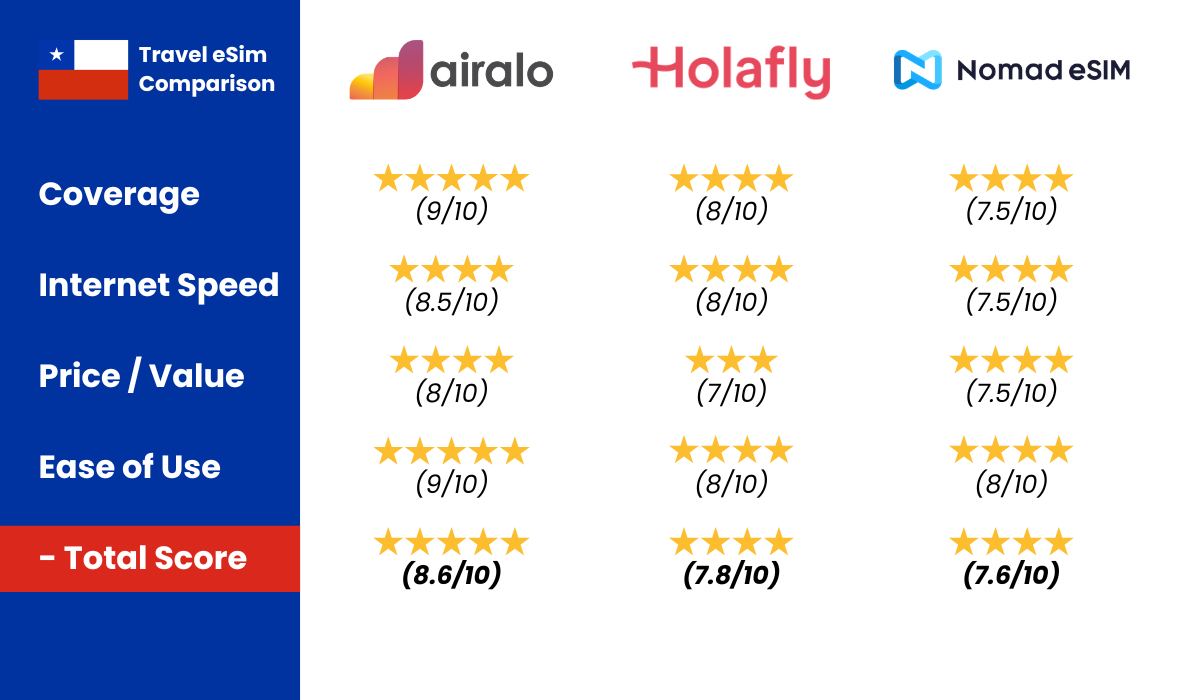
    Short and sweet: the cheapest eSIM Chile travelers can get in 2026 is Airalo.


    Chile eSIM comparison: Airalo vs Holafly vs Nomad
    We’ve compared Airalo, Holafly, and Nomad side by side. Click here for our full Chile eSIM comparison.

    Official sources: Airalo Chile plans

    The cheapest eSIM for Chile starts around a few dollars for short trips; compare data limits before choosing a budget plan.

    I’ve used it myself and compared it to other options. It gives you the lowest starting price, flexible bundles, and no hidden airport markups. If you want the details on pricing, coverage, and whether it is truly cheaper than a local SIM, keep reading.

    New to Airalo? Get $3 off this week with code KJ2068. Download the Airalo App now.

    Here is my quick rating:

    Coverage: 9/10 ⭐⭐⭐⭐⭐
    Speed: 8.5/10 ⭐⭐⭐⭐
    Price/value: 9/10 ⭐⭐⭐⭐⭐
    Ease of installation: 9/10 ⭐⭐⭐⭐⭐

    New to Airalo? Get $3 off this week with code KJ2068. Download the Airalo App now.

    Cheapest eSim Chile option

    Landing in Santiago without data sounds harmless until you need:

    • Uber from the airport
    • Google Maps
    • Booking confirmations
    • WhatsApp
    • Bank verification codes

    Many travelers think buying a local SIM in Chile will be cheaper. Sometimes it is. Sometimes it is not.

    You often deal with:

    • Passport registration
    • Spanish paperwork
    • Airport pricing
    • Closed shops in smaller towns

    An eSIM removes all of that. The question is not just price per GB. It is total hassle cost.

    That is why I looked for the cheapest eSIM Chile option that still works reliably.

    Airalo as the cheapest eSim Chile option

    Airalo offers small, affordable data bundles that start very low. That is what makes it stand out.

    Instead of forcing you into expensive unlimited plans, you choose exactly how much data you need.

    If you mostly use:

    • Maps
    • WhatsApp
    • Instagram
    • Light browsing

    You do not need a massive package.

    My experience was simple. Fast setup. No surprises. No hidden fees. And when I needed more data, topping up took less than a minute inside the app.

    That flexibility is what makes it the cheapest eSIM Chile travelers can realistically use.

    Airalo coverage in Chile

    Overall 9/10.

    In cities like Santiago, Valparaiso, and Concepcion, coverage is strong and stable.

    In smaller towns it performs well too.

    Only in remote areas like high mountains or places like Termas Geometricas did signal disappear. That happens with every provider in Chile.

    For normal travel routes, it works perfectly.

    Esim Chile internet speed

    Chile has excellent mobile infrastructure compared to most of South America.

    With Airalo, speeds in Santiago were more than enough for:

    • Streaming
    • Video calls
    • Navigation
    • Social media

    In smaller towns the speed drops slightly, but it is still smooth for daily use.

    Again, remote mountain areas are a different story. That is infrastructure, not the eSIM.

    Cheapest esim Chile pricing in 2026

    This is where Airalo wins.

    Plans typically start very low for small data packages. You can go from entry-level bundles to larger ones depending on your trip length.

    For budget travelers, the key is this:

    You are not forced into unlimited.

    You pay for what you actually use.

    For most 2–3 week Chile trips, 5GB to 10GB is enough unless you stream constantly.

    Always check the latest pricing in the app because offers change.

    New to Airalo? Get $3 off this week with code KJ2068. Download the Airalo App now.

    How to install the Airalo eSim

    It is straightforward.

    1. Download the Airalo app
    2. Select Chile
    3. Choose your data package
    4. Follow the installation steps
    5. Activate when you land

    The app walks you through everything step by step.

    I was connected within minutes after landing.

    How to add more data

    When you run low, the app sends a notification.

    You open it, choose a top-up, confirm payment, and within seconds your data is active again.

    No shop visits. No SIM swapping.

    Tip: turn off background data for apps you do not use often. That helps stretch even the smallest bundle.

    Is it cheaper than a local Chile SIM card?

    This depends.

    If you stay for months and speak Spanish, a local prepaid SIM might be slightly cheaper per GB.

    But for most travelers staying 1–4 weeks, the price difference is small.

    When you factor in time, airport convenience, and no paperwork, Airalo often ends up being the cheapest practical option.

    Especially if you use a smaller data bundle.

    Compatibility with iPhone and Android

    Most modern phones support eSIM.

    That includes:

    • iPhone SE 2020 and newer
    • iPhone XR and newer
    • Recent Samsung Galaxy models
    • Google Pixel devices

    If your phone supports eSIM, you are good to go.

    When should you buy your eSIM?

    Buy it 2–3 days before departure.

    Install it at home on WiFi.

    When you land in Chile, switch on mobile data and you are online instantly.

    No airport stress.

    Final verdict: cheapest esim Chile in 2026

    If your priority is low cost without sacrificing reliability, Airalo is the cheapest eSIM Chile travelers can confidently use.

    It offers:

    • Low starting prices
    • Flexible bundles
    • Reliable coverage
    • Easy setup
    • Fast top-ups

    You are not paying for features you do not need.

    For most travelers, that is the smartest way to stay connected in Chile without overspending.

    Frequently asked questions

    What should travelers know about Cheapest eSIM Chile?

    The cheapest eSIM for Chile starts around a few dollars for short trips; compare data limits before choosing a budget plan.

    Quick pick: For most travelers, Airalo is the easiest Chile eSIM to set up before you fly. Compare all providers in our full eSIM comparison, see cheapest Chile eSIM plans, or read region-specific guides for Patagonia, Atacama, or Easter Island.

  • Driving in Santiago (2026 Guide)

    Driving in Santiago (2026 Guide)

    I thought driving in Santiago would just be “big city traffic”. I had driven in Paris, Munich, even Amsterdam at rush hour. I assumed I knew what I was getting into. I did not.

    Official sources: US Embassy Chile

    Driving in Santiago feels like controlled chaos. Not reckless chaos. Not complete madness. But a constant, fast moving, highly alert kind of chaos where you have to participate or you will get swallowed.

    And this is important.

    Santiago is not the rest of Chile. Driving here feels nothing like driving in the Lake District. Nothing like Patagonia. Nothing like the desert roads in the north. This is dense, fast, urban traffic with toll highways cutting straight through the city.

    The first time I drove here, I gripped the steering wheel tighter than anywhere else in Chile. By the third day, I understood the rhythm. And once you understand the rhythm, it becomes manageable.

    This is not a rulebook. It is real experience, from behind the wheel in Chile’s capital.

    Some basics

    • You drive on the right
    • There are potholes, even on roads that look perfectly fine
    • Bring enough cash for tolls, it adds up quickly
    • Waze is the most used navigation app, not Google Maps, and it shows speed cameras
    • Animals can walk freely on the road, including dogs, sheep, and horses

    Still need to rent a car?

    If you have decided that driving in Santiago makes sense for your trip, renting a car is straightforward. The airport has the widest selection, but you can also pick up vehicles in neighborhoods like Las Condes or Providencia.

    Before booking, always check how toll roads are handled. Santiago’s highways are electronic, so make sure the car includes a TAG device and that you understand how toll charges are billed.

    DiscoverCars is an easy way to compare rental companies in Santiago. You can filter by transmission type, insurance coverage, pickup location, and read real traveler reviews before committing.

    In a city this busy, clarity before pickup saves you a lot of stress later.

    Things that I found

    • DANGEROUS: headlights are often pointed too high, you will get blinded at night
    • Diesel and gasoline are not cheap, attendants fill up your car and you tip them
    • Driving up mountains requires attention, not every corner has guard rails
    • People will guide you where to park, watch your car for safety, and expect a tip
    • Drivers are aggressive in cities but surprisingly calm on highways
    • There are many crosses next to the road, often because people walk along highways, even at night
    • Toll roads often require cash and the total cost can rise fast
    • Copec gas stations are excellent for quick snacks and unlimited refill drinks
    • Gas stations can be very far apart, especially outside cities, plan ahead to avoid getting stranded
    • When parking, be careful for the dogs that walk around.

    Signage and markings

    All the speed limits are in km/h, NOT in miles/h.

    Parking in Santiago

    Parking in Santiago depends entirely on the area.

    Malls are easy. Plenty of space, clear systems, structured parking garages. It feels organized.

    Street parking is different. In some neighborhoods it is paid and regulated. In others, informal attendants will guide you into a space and expect a tip. This is normal.

    In business districts like Las Condes or Providencia, parking garages are common but can be expensive. In older central areas, parking can feel chaotic and limited.

    Always double check signs. Fines are real, and towing happens.

    Driving in Santiago

    Driving in Santiago requires confidence.

    People merge without hesitation. Lanes compress quickly. If you wait politely for someone to let you in, you may wait forever. You need to indicate clearly, move decisively, and commit.

    It feels intense at first. Constant mirror checks. Constant anticipation.

    But strangely, it works. Drivers expect assertiveness. Once you match the rhythm, traffic flows.

    Red lights turning yellow are often treated as “last chance to go”. Stay alert, especially at intersections late in the day.

    Highways and toll system

    This is where many tourists get confused.

    Santiago has urban highways running directly through the city. They are fast, modern, and fully electronic. There are no traditional toll booths.

    Instead, vehicles use a TAG device. Cameras detect the plate and charge electronically. If your rental car has a TAG, the tolls are recorded and billed later.

    If it does not, you can receive fines.

    These highways are convenient. They save huge amounts of time. But they add cost quickly if you use them daily.

    Always ask your rental company exactly how tolls are handled.

    City driving vs outskirts driving

    Driving inside Santiago feels compressed and fast.

    Driving just outside the city feels completely different.

    Once you leave the dense urban core and head toward the Andes or wine regions, traffic thins out quickly. Highways become calmer. Landscapes open up. It starts to feel like the rest of Chile again.

    The adjustment between these two environments happens within minutes. One moment you are navigating six lanes of traffic. Ten minutes later, you are cruising toward the mountains.

    That contrast is what makes driving in Santiago unique.

    Driving at night

    Driving at night in Santiago is easier than rural night driving in Chile, but it comes with its own stress.

    Traffic lights, reflections, and fast merging lanes demand focus. Some drivers become even more aggressive when roads are less crowded.

    In winter, smog can reduce visibility slightly. In some areas, lighting is excellent. In others, it is darker than you would expect for a capital city.

    If you are not comfortable with dense urban traffic, avoid late evening drives in unfamiliar areas. During the day, navigation is much easier.

  • Patagonia eSIM (2026 Guide)

    Patagonia eSIM (2026 Guide)

    Short answer?
    The best Patagonia eSIM in 2026 is Airalo.

    Connectivity is one booking. The trip shape is in our Patagonia travel guide.


    Chile eSIM comparison: Airalo vs Holafly vs Nomad
    We’ve compared Airalo, Holafly, and Nomad side by side. Click here for our full Chile eSIM comparison.

    For Patagonia you need an eSIM with broad Chile coverage; some remote roads have weak signal even with major providers.

    I’ve tested it myself in Chile and specifically looked into how it performs in Patagonia, because this is where most eSIMs get exposed. Big cities are easy. Patagonia is not.

    New to Airalo? Get $3 off this week with code KJ2068. Download the Airalo App now.

    If you are going to places like:

    • Torres del Paine
    • Puerto Natales
    • El Calafate
    • El Chaltén
    • Carretera Austral
    • Punta Arenas

    You need something reliable.
    🏆 Winner: Airalo
    (I like to cut to the chase). Read more below:

    Why you absolutely need an eSIM in Patagonia

    Patagonia is not Santiago.

    There are:

    • Long empty highways
    • Sudden weather changes
    • Border crossings between Chile and Argentina
    • National parks with limited infrastructure

    And Reddit is full of the same questions:

    “Will I have signal in Torres del Paine?”
    “Does eSIM work on the Carretera Austral?”
    “Should I buy a SIM in Puerto Natales instead?”
    “Is there coverage in El Chaltén?”

    The honest answer?

    You will not have signal everywhere. That is Patagonia.

    But you do want reliable data in:

    • Town centers
    • Airports
    • Bus stations
    • Restaurants
    • Booking accommodations
    • Emergencies

    That is where Airalo performs best.

    Airalo: the best Patagonia eSIM right now

    Airalo connects to major local networks in Chile and Argentina. That matters because smaller eSIM brands often piggyback on weaker partner agreements.

    In real life, here is what that means:

    In towns like Puerto Natales, Punta Arenas, El Calafate, and El Chaltén, coverage is strong and stable.

    Once you go deep into Torres del Paine or remote hiking routes, signal drops. But that happens with literally every provider.

    There is no magical Patagonia eSIM that gives full signal in the mountains.

    Patagonia eSIM coverage

    Let’s be realistic.

    Puerto Natales

    Strong 4G. Works perfectly for maps, bookings, WhatsApp.

    Punta Arenas

    Very solid coverage. Fast speeds.

    El Calafate

    Reliable. No issues for streaming or navigation.

    El Chaltén

    Good inside the town. Limited once you start hiking.

    Torres del Paine National Park

    Signal only near entrances, hotels, or certain lodges.
    Once on the W Trek or O Circuit, assume no service.

    Carretera Austral

    Works in larger villages. Expect long dead zones between towns.

    This is normal for Patagonia. Not an eSIM issue.

    Patagonia eSIM internet speed

    In towns, Airalo feels fast.

    • Google Maps loads instantly
    • Booking apps work smoothly
    • Instagram and YouTube run fine
    • Video calls possible in urban areas

    In remote zones, speed drops before disappearing.

    Again, this is Patagonia infrastructure, not the eSIM provider.

    Chile vs Argentina Patagonia: Do you need two eSIMs?

    Very common Reddit question.

    If you are crossing borders between:

    • Puerto Natales and El Calafate
    • Punta Arenas and Ushuaia
    • Chilean Patagonia and Argentine Patagonia

    You need either:

    • A regional eSIM covering both countries
      OR
    • Two separate country plans

    Airalo offers both Chile-only and Argentina-only options, plus regional packages.

    For most Patagonia travelers doing both sides, the regional plan is easiest.

    No swapping SIMs at border crossings. Just drive through and stay connected.

    Patagonia eSIM prices (2026)

    Airalo plans usually range roughly from:

    • Small data packages for short trips
    • Larger bundles if you use maps constantly

    I personally recommend:

    5GB to 10GB for a 2–3 week Patagonia trip.

    Why?

    Because you will not have signal while hiking. So your actual usage is lower than in city travel.

    Always check the latest pricing on the Airalo website.

    New to Airalo? Get $3 off this week with code KJ2068. Download the Airalo App now.

    One of the things I liked about Airalo is the flexibility. There are plenty of data bundles to choose from, depending on how much you use your phone. As of writing this article, the prices range from about €4.50 for 1 GB up to €42.50 for 20 GB. I personally started with the smaller pack of 10GB and then topped up when I needed more.

    Since prices can change, you can always check the most up-to-date offers directly on the Airalo Chile page.

    How to install your Patagonia eSIM

    Very simple:

    1. Download the Airalo app
    2. Choose Chile, Argentina, or regional South America
    3. Purchase your data package
    4. Follow the installation steps
    5. Activate when you land

    I always install it at home before departure.

    When the plane lands in Punta Arenas or El Calafate, I just turn on mobile data and I am connected instantly.

    No airport SIM hunting.

    Should you buy a local SIM in Patagonia instead?

    Short answer: not worth the hassle.

    In small towns like Puerto Natales or El Chaltén:

    • Shops close early
    • English is limited
    • Lines can be slow
    • Passport registration required

    After a long travel day, the last thing you want is paperwork.

    With Airalo, you are online in minutes.

    Is unlimited data necessary?

    In my opinion, no.

    Unlimited plans sound attractive. But remember:

    Large parts of Patagonia have no coverage anyway.

    You are hiking, driving, exploring.

    You are not binge watching Netflix.

    A solid data bundle is more than enough.

    When Should You Buy Your Patagonia eSIM?

    Buy it 2–3 days before departure.

    Install it at home where you have stable WiFi.

    Then activate once you land.

    Stress-free arrival.

    Is Airalo Really the best Patagonia eSIM?

    For me, yes.

    It gives:

    • Strong town coverage
    • Reliable speed
    • Easy border transitions
    • Simple installation
    • Fair pricing
    • Fast top-ups

    Does it give full signal on a glacier? No.

    Nothing does.

    But for actual travel logistics in Patagonia, it is the most reliable choice right now.

    Final Verdict

    If you want:

    ✔ Easy setup
    ✔ Good coverage in Patagonia towns
    ✔ No airport SIM stress
    ✔ Simple border crossings
    ✔ Reliable travel internet

    Airalo is the best Patagonia eSIM available right now.

    New to Airalo? Get $3 off this week with code KJ2068. Download the Airalo App now.

    You can Download the Airalo app and set everything up in under 5 minutes.

    And once you land in Patagonia, you are already connected. No drama.

    Frequently asked questions

    What should travelers know about Patagonia eSIM?

    For Patagonia you need an eSIM with broad Chile coverage; some remote roads have weak signal even with major providers.

    Quick pick: For most travelers, Airalo is the easiest Chile eSIM to set up before you fly. Compare all providers in our full eSIM comparison, see cheapest Chile eSIM plans, or read region-specific guides for Patagonia eSIM guide.

  • Villarrica Volcano (2026 Guide)

    Villarrica Volcano (2026 Guide)

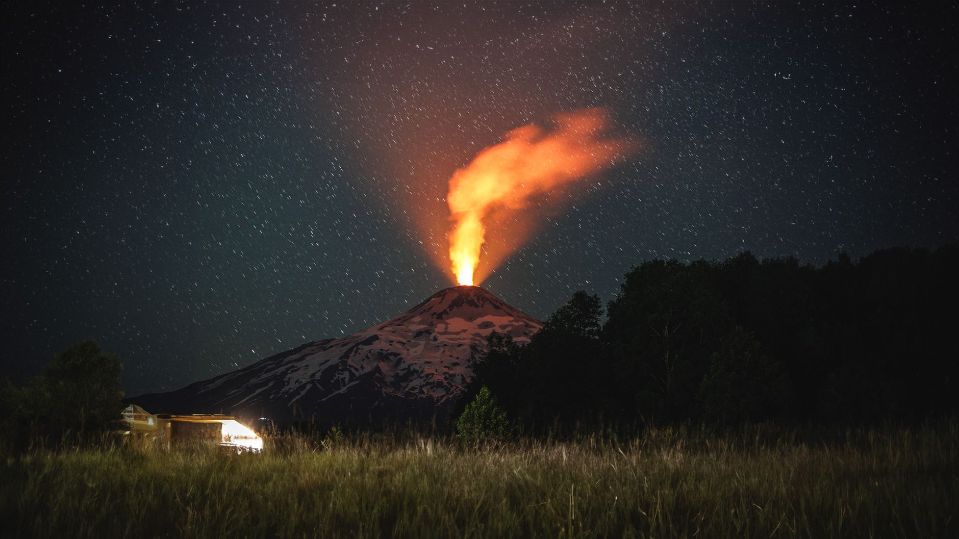
    You leave Pucón, drive past wooden cabins and forested roads, and then it appears. A perfect white cone rising straight above the town, often with a thin line of smoke drifting from the top.

    Official sources: SERNAGEOMIN

    That is Villarrica Volcano 🌋

    Unlike many volcanoes you only admire from a distance, this one is alive. It is one of the most active volcanoes in South America. And yes, you can actually climb it.

    This is my take on visiting Villarrica Volcano, what to expect, when to go, and whether the hike is really worth it.

    Villarrica Volcano

    Villarrica Volcano is one of the most iconic landmarks in Chile’s Lake District and the main reason many travelers visit Pucon.

    It stands at 2,847 meters and is known for its near perfect cone shape and snow covered summit. What makes it special is that it is still active. On clear days, you can sometimes see smoke rising from the crater.

    From Pucon’s lakeshore you already get incredible views. The volcano dominates the skyline. Whether you are kayaking on Lake Villarrica or walking through town, it is always there.

    Unlike Osorno, Villarrica feels more raw and adventurous. It is less about scenic driving and more about action.

    Villarrica Volcano location

    Villarrica Volcano location is in southern Chile, inside Villarrica National Park, between the towns of Pucon and Villarrica.

    Pucon is the main base for visitors and sits right on Lake Villarrica. From town, it takes about 20 to 25 minutes by car to reach the ski center area on the volcano.

    Because of its location, it is easy to combine with:

    • Lake Villarrica
    • Termas Geometricas
    • Huerquehue National Park
    • Ojos del Caburgua

    The volcano rises directly behind Pucon, which makes it impossible to miss.

    Driving from Pucón

    Driving to Villarrica Volcano from Pucón is easy and scenic, and it gives you full control over your timing. The distance is short, around 12 km, and normally takes about 20 to 30 minutes depending on traffic and road conditions.

    The road climbs steadily toward the volcano, and as you leave town, the forest starts to thicken around you. On clear days, the snow covered summit appears dramatically above the trees, and you can already see steam rising from the crater if the volcano is active.

    A quick stop before heading up

    Before driving up, it is practical to stop in Pucón town to grab snacks, water, or sunscreen. There are several supermarkets and small shops along Avenida O’Higgins. Once you start ascending toward the national park entrance, there are no major stores.

    Driving yourself

    Driving is the most flexible way to visit Villarrica Volcano. You can:

    • Arrive early to avoid crowds
    • Stay as long as you like
    • Combine it with nearby hot springs or viewpoints
    • Leave quickly if weather conditions change

    The road is paved most of the way. The final section inside the national park can feel steeper and occasionally rough, especially after winter. In summer, a standard car is usually enough. In winter, snow and ice are common, and authorities may require snow chains.

    Always check volcanic activity status before going. If activity levels rise, access to higher areas may be restricted.

    Tours from Pucón

    If you prefer not to drive, many guided tours depart directly from Pucón. Most volcano hikes include:

    • Transport to the park entrance
    • Certified mountain guides
    • Safety equipment
    • Pickup from your hotel

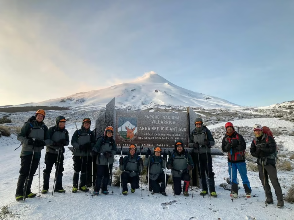
    For the summit hike, going with a licensed guide is mandatory. Conditions on the volcano change quickly, and professional supervision is required.

    Height of the volcano

    Villarrica Volcano height is 2,847 meters.

    That makes it one of the taller volcanoes in the region, but still accessible for fit travelers through guided climbs.

    The elevation gain during the Villarrica Volcano hike is significant, which is why the ascent feels demanding even for experienced hikers.

    Villarrica Volcano active status

    Yes, Villarrica Volcano is active.

    It has a long history of eruptions and is constantly monitored by Chilean authorities. Activity levels can change, and sometimes access to the summit is restricted depending on volcanic behavior.

    Its activity is also what makes it famous for having a lava lake inside the crater during certain periods.

    Last eruption

    The Villarrica Volcano last eruption occurred in 2015, when lava fountains and ash columns forced evacuations around Pucon.

    Since then, there have been smaller activity phases, but nothing on the same scale.

    Because of this history, safety checks are taken seriously. If activity increases, climbs are suspended.

    Always check current status before planning your visit.

    Is hiking possible?

    Yes, hiking Villarrica Volcano is possible, but it is very different from a normal mountain hike.

    This is not just a scenic walk. It is a high altitude volcanic ascent on one of Chile’s most active volcanoes, and conditions can change quickly.

    The standard summit route is approximately:

    • 9 km out and back
    • Around 1,400 meters of elevation gain
    • Rated hard
    • 5 to 7 hours round trip depending on pace and conditions

    What the hike involves

    Climbing Villarrica Volcano means:

    • Steep volcanic terrain with loose ash and gravel
    • Snow and ice fields for most of the year
    • Strong winds near the summit
    • Rapid weather changes
    • No facilities once you leave the base area

    Higher up, the terrain becomes snow covered even in summer. Near the crater, you may see steam rising from the active vent, and on clear days you can sometimes glimpse the lava lake deep inside.

    Is this hike for everyone?

    No.

    This is not a casual viewpoint walk. While many visitors explore short trails near the ski center inside Villarrica National Park, the full summit hike requires:

    • Good physical fitness
    • Comfort with steep ascents
    • Proper hiking boots
    • Layered clothing for wind and cold
    • Helmet, crampons and ice axe

    Even in summer, guides typically provide crampons and an ice axe for the upper section.

    Guided vs unguided hiking

    For the summit, going with a certified guide is mandatory.

    Due to volcanic activity, snow conditions, and safety regulations, independent summit hikes are not allowed. Local agencies in Pucón provide:

    • Transport to the park
    • Professional mountain guides
    • Safety equipment
    • Briefings on current volcanic conditions

    Crevasses, unstable snow, and sudden gas emissions are real risks. Conditions are monitored constantly, and access may be restricted if activity increases.

    Bottom line

    Hiking Villarrica Volcano is possible, but it is physically demanding and conditions dependent. If you are looking for a serious adventure with the chance to peer into an active crater, this is one of the most unique climbs in South America.

    If you simply want impressive views, the lower access areas and surrounding trails already offer incredible scenery without committing to the full ascent.

    Day trips

    Climb the imposing Villarrica Volcano, the most active in South America. Be amazed at the summit and see the geological formation of the crater with its constant activity.

    CHECK AVAILABILITY HERE:

    Villarrica Volcano lava lake

    One of the most fascinating features is the Villarrica Volcano lava lake.

    During periods of higher activity, you can sometimes see glowing lava inside the crater. It is not guaranteed, and visibility depends on both volcanic activity and weather conditions.

    Seeing the lava lake is rare but possible. Even without visible lava, standing at the crater rim is a powerful experience.

    Villarrica Volcano tour

    Booking a Villarrica Volcano tour is the standard way to summit.

    Tours typically include:

    • Transport from Pucon
    • Helmet
    • Ice axe
    • Crampons
    • Safety briefing
    • Certified mountain guide

    Prices usually range between 80 and 120 USD depending on season.

    If you do not want to summit, you can also visit the lower ski area independently for panoramic views without the full hike.

    Villarrica Volcano map

    On a Villarrica Volcano map, you will see it located directly east of Pucon within Villarrica National Park.

    The ski center marks the main access point. From there, summit routes head straight up the cone.

    It is helpful to check a map before going, especially if you plan to drive yourself to the starting point.

    Best time to visit

    Summer (December to March)

    Best weather conditions
    More stable access
    Higher chance of summit attempts

    Shoulder season (October to November, April)

    Fewer visitors
    More unpredictable weather

    Winter (June to September)

    Heavy snow
    Very scenic
    Access depends on conditions

    Weather changes fast in the Lake District. Always aim for clear mornings if possible.

    Visit Villarrica Volcano

    Villarrica Volcano is one of the most dramatic experiences in Chile’s Lake District.

    It is active. It has erupted in recent history. It sometimes holds a lava lake. And you can stand on top of it.

    Whether you choose a full Villarrica Volcano hike or simply admire it from Pucon, it adds energy and raw power to the entire region.

    If you are staying in Pucon, visiting Villarrica Volcano should be high on your list.

  • Santiago to Temuco (2026 Guide)

    Santiago to Temuco (2026 Guide)

    Planning your trip from Santiago to Temuco and looking for the best and cheapest options? It is a long trip, about 680 km, so your choice really matters for comfort, time, and budget.

    Before you go: install a reliable eSIM for Patagonia’s remote areas so you have maps and messaging when cell signal drops.

    I have done the Santiago to Temuco route several times, and this guide breaks down the options in a simple, practical way so you can choose what fits your trip.

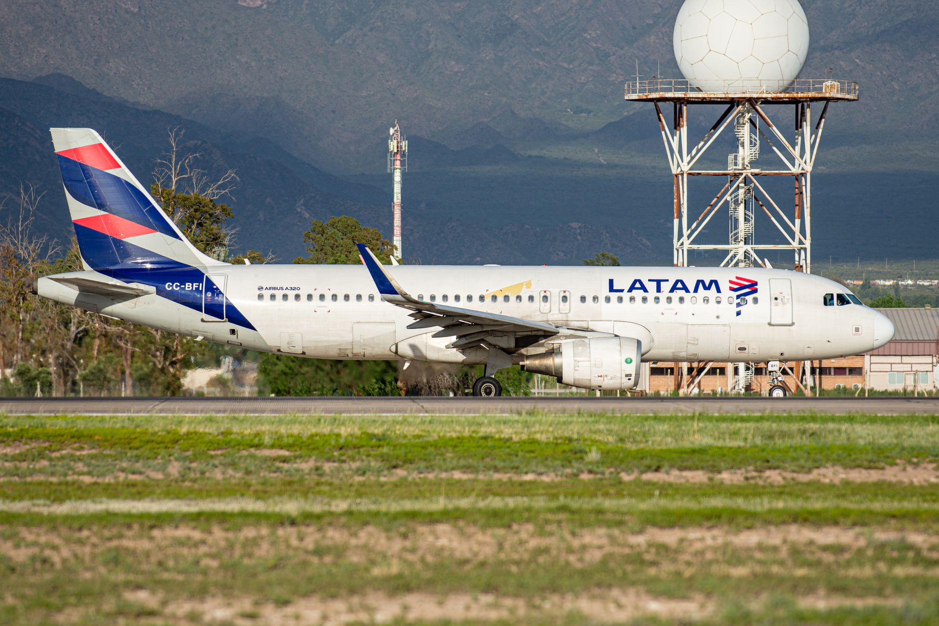
    I personally flew with LATAM Airlines from Santiago to Temuco and back, but flying is not the only option worth considering.

    Overview of Santiago to Temuco

    Traveling from Santiago to Temuco means crossing a big part of central and southern Chile. The distance is roughly 680 km, so this is not a short hop. Planning ahead makes a real difference.

    Here is what you should expect on this route:

    • Travel times range from 1 hour 20 minutes by plane to 9–10 hours by bus or car
    • Most travelers choose flying or overnight buses
    • Roads are generally good, but the trip is long if you drive
    • Prices vary a lot depending on season and booking time

    This route is popular with both locals and international travelers heading into the Araucanía region, especially in summer and during holidays.

    Choosing the right transport depends on how much time you have, how much luggage you carry, and how flexible your budget is.

    Travel methods

    Personal experience taught me that there are comfortable ways to travel from Santiago to Temuco, and some that feel long very quickly.

    Your choice depends mainly on:

    • Budget
    • Time available
    • Comfort expectations
    • How much luggage you travel with

    Below are the main travel methods, with what you realistically need to know.

    By plane

    Flying is the fastest and often the most comfortable way to travel from Santiago to Temuco.

    What to expect when flying:

    • Airlines mainly include LATAM Airlines and Sky Airline
    • Flight time is about 1 hour 20 minutes
    • Flights leave from Santiago Airport and land at La Araucanía International Airport, about 20 minutes from Temuco

    Things to watch out for:

    • Basic fares often include no checked luggage
    • Seat selection and bags cost extra
    • Prices rise fast close to departure dates

    I flew with LATAM on this route and it was smooth, but baggage rules can catch you by surprise.
    Read my LATAM Airlines review for Santiago to Temuco flights to avoid common mistakes.

    By bus

    Buses are the most popular option for budget travelers and locals.

    Here is how bus travel looks on this route:

    • Several companies operate daily, including Tur Bus and Pullman
    • Comfort ranges from semi cama to full cama seats
    • Travel time is usually 9 to 10 hours

    Key differences to consider:

    • Night buses save on accommodation and are usually quieter
    • Day buses let you see the landscape but feel longer
    • Comfort depends heavily on seat type, not just the company

    Bus terminals:

    • Santiago departures usually leave from Terminal Alameda
    • Buses arrive at Temuco Bus Terminal, close to the city center

    If budget matters more than speed, this is often the best value option.

    By car

    Driving gives you flexibility, but it is not always the easiest choice.

    Important points about driving:

    • Distance is about 680 km
    • Driving time is 8 to 9 hours, without long stops
    • Roads are generally in good condition, mostly on Route 5

    When renting a car makes sense:

    • You plan to explore rural areas around Temuco
    • You travel with multiple people
    • You want full flexibility after arrival

    Downsides to consider:

    • Fuel and toll costs add up
    • It is a long day behind the wheel
    • Renting one way can be expensive

    If you want full control of your route, driving works. If Temuco is your final stop, flying or buses are usually easier. You could also rent a car in Temuco. You can read more in my renting a car in Santiago guide if you consider this option.

    Comparing costs and time

    Costs and travel time from Santiago to Temuco can be very different depending on how you travel, how far in advance you book, and the season.

    Flying can be cheap and fast if you book early and travel light, but prices jump quickly close to departure.
    Buses are slower, but prices stay much more stable throughout the year.

    Driving sits on the other end of the scale. It gives flexibility, but fuel, tolls, and rental costs add up fast.

    The table below shows a realistic comparison based on typical traveler experiences, not just best case prices.
    It should help you decide quickly which option fits your schedule and budget best.

    Travel method Travel time One way cost Best for
    Plane 1h 20m flight+ airport time USD 40–120 Speed and comfort
    Bus (night) 9–10 hours USD 25–45 Budget travelers
    Bus (day) 9–10 hours USD 25–45 Scenic travel
    Car (rental) 8–9 hours USD 120–200+ Flexibility

    A few things to keep in mind:

    • Flights are often cheapest if booked early and with light luggage (check Google Flights for best pricing)
    • Night buses offer the best value for money
    • Driving only makes sense if you need a car after arriving

    If time is limited, flying wins easily. If budget matters most, overnight buses are hard to beat. This comparison usually makes the choice clearer before you book.

    Go further south

    For most travelers, Temuco is not the final destination. It is more of a gateway to southern Chile. From Temuco, you are well placed to explore the Lake District, one of the most diverse and scenic areas in the country.

    Popular places to continue your trip include:

    • Pucón for volcano views, hot springs, and outdoor activities
    • Valdivia for rivers, seafood, and a relaxed vibe
    • Puerto Montt as a hub for Patagonia and Chiloé

    If you want ideas, routes, and realistic travel times, check our Lake District guide to see what fits your itinerary best.

    From here, going further south is easy, whether by bus, car, or short flights.

  • LATAM Airlines Chile (2026 Guide)

    LATAM Airlines Chile (2026 Guide)

    So I took LATAM Airlines from Santiago to Temuco and back. Going to Temuco I went in the back, and the way back I took the first class. This blog will discuss my personal experience, wether or not upgrading is worth it and.

    Official sources: LATAM Airlines

    What if there’s a link right here with bghl?

    My LATAM Airlines review

    For this review, I flew twice with LATAM Airlines Chile on the same route. From Santiago to Temuco and a few days later from Temuco back to Santiago.

    The outbound flight was in regular Economy Class, seated in the back of the plane. The return flight was in Premium Economy, seated in the front. Same route, same airline, but a very different experience.

    That made it easy to compare comfort, leg room, boarding, and overall flight experience in a realistic way, especially for domestic flights in Chile.

    Santiago to Temuco (Economy Class)

    This flight came at the end of a long journey: Amsterdam (AMS) to Atlanta (ATL) to Santiago (SCL) and finally Temuco (ZCO), all within about 24 hours, including a seven hour layover in Atlanta.

    Compared to the international legs with Delta and KLM, the leg room on this domestic LATAM flight was noticeably tighter. Sitting in the back of the plane, space was limited to the point where my foot was partially in the aisle. At one moment, the cabin crew could not move the food cart through because there simply was not enough clearance (oops, my bad…)

    Boarding was straightforward. Passengers with priority status boarded first, followed by the rest of the cabin. Drinks were served roughly thirty minutes into the flight, which felt reasonable given the short duration.

    Temuco to Santiago (Premium Economy)

    The return flight from Temuco to Santiago was in Premium Economy, and the difference compared to regular Economy was immediate.

    Thanks to priority boarding, I was one of the first on the plane. I boarded around fifth, which already set a relaxed tone. No one sat next to me, and for the first time on this route I actually had enough leg room to fully stretch my legs.

    Premium Economy also comes with dedicated cabin crew. Drinks were offered multiple times, snacks were included, and even hot towels were handed out. Small details, but they make a noticeable difference on a domestic flight.

    Overall, it genuinely felt like a premium experience. For the small price difference, especially if you value comfort or are tall, I would absolutely say Premium Economy on LATAM Airlines Chile is worth it.

    Prices

    LATAM Airlines Chile usually offers four fare packages on domestic flights: Basic, Light, Full, and Premium Economy.

    The biggest difference between these options is luggage, flexibility, and comfort.

    If you are traveling with a large checked suitcase like I was, you realistically only have two options: Full or Premium Economy. Both include a 23 kg checked bag and more flexibility if your plans change.

    If you are only bringing a small backpack or handbag, Light is usually more than enough and keeps the price low. Basic can look cheap at first, but it is very restrictive and often not worth it unless you are traveling extremely light and do not need any flexibility.

    Premium Economy is the most expensive option, but you get more leg room, priority boarding, better service, and lounge access. For a relatively small price difference on short Chilean routes, it offers the best overall value if comfort matters to you.

    Leg room and seat comfort

    I am 194 cm (6’4), so leg room is always something I pay attention to. On the flight to Temuco, seated in the back of the plane, it was honestly tough. The photo below pretty much says it all. My knees simply did not fit, while the passengers next to me had no problem at all.

    The seats themselves were comfortable enough in terms of padding and back support. For an average Chilean height, leg room in Economy is perfectly fine. If you are tall though, especially over 190 cm, it can get uncomfortable quickly on this route.

    If leg room matters to you, I would seriously consider Premium Economy. The difference is noticeable and makes the flight far more relaxed.

    Baggage allowance and carry on rules

    LATAM Airlines Chile offers four fare types, each with different baggage rules:

    • Basic
      • Small personal item only
      • No checked baggage
      • Changes allowed with fee and fare difference
    • Light
      • Small personal item
      • Small carry on up to 12 kg
      • No checked baggage
    • Full
      • Small personal item
      • Carry on up to 12 kg
      • 1 checked bag up to 23 kg
      • More flexibility for changes and refunds
    • Premium Economy
      • Small personal item
      • Carry on up to 16 kg
      • 1 checked bag up to 23 kg
      • Priority boarding
      • Middle seat blocked and extra leg room

    If you travel with a large suitcase, Full or Premium Economy is basically your only realistic option. If you are traveling light with just a backpack, Light is usually enough and much cheaper.

    Cabin crew

    The cabin crew on both flights were Chilean and very professional. They were friendly, calm, and clearly experienced.

    English was spoken well enough to communicate without any issues, which is reassuring if you do not speak Spanish. Service felt organized and efficient, exactly what you would expect from a full service airline like LATAM.

    Nothing over the top, but solid, reliable, and professional throughout the flight.

    Would I fly LATAM Airlines in Chile again?

    Yes, absolutely. Going from Santiago to Temuco, it’s a great value for my buck and it’s great for domestic flights all over Chile. The amount of leg room I get for not that much more money is definitely worth it for me.

  • Osorno Volcano (2026 Guide)

    Osorno Volcano (2026 Guide)

    You leave Puerto Varas, follow the edge of the lake, and suddenly a perfect white cone starts filling your windshield. Forests fade, the road climbs, and before you know it you are parking on the side of a volcano, looking out over Lake Llanquihue.

    Official sources: SERNAGEOMIN

    This is my personal take on visiting Osorno Volcano, one of the most iconic sights in Chile’s Lake District.

    It is not just about the volcano itself, but the feeling of slowly driving straight toward it. Snow on top, deep blue water below, and views that make you stop more than once just to take it all in.

    The Osorno volcano

    The Osorno Volcano is one of the most iconic sights in Chile’s Lake District and for many travelers the main reason to visit Puerto Varas. With its almost perfect cone shape, snow covered summit, and dramatic contrast against green forests and deep blue lakes, it looks like something straight out of a postcard.

    On clear days, the views are incredible. From the Puerto Varas waterfront you can already see Osorno rising behind Lake Llanquihue, and it only gets better as you drive closer, for example from this viewpoint where I took the picture below. The road up the volcano is a highlight in itself, with multiple natural viewpoints where it is absolutely worth pulling over. No matter where you are around the lake, Osorno dominates the skyline and constantly draws your attention.

    Driving up the volcano feels like slowly entering a different landscape. Forests fade, volcanic rock becomes more visible, and the air gets colder as you climb. Even if you do not plan to hike or take the chairlift, the drive alone is worth it. The combination of lake views, distant peaks, and Osorno’s massive presence makes this one of the most breathtaking spots in the Lake District.

    Osorno Volcano location

    The Osorno Volcano is located in southern Chile’s Lake District, in the Andes mountain range, right on the edge of Vicente Pérez Rosales National Park. This makes it incredibly easy to combine with other natural highlights in the area.

    Osorno sits on the southern shore of Lake Llanquihue, one of the largest lakes in Chile. From almost anywhere around the lake, the volcano is visible, but the most famous views are from Puerto Varas, which lies about 45 minutes away by car. Many visitors base themselves in Puerto Varas and visit Osorno as a half day or full day trip.

    Thanks to its location inside a national park, the surroundings are well preserved and feel wild, even though access is straightforward. You are close to forests, waterfalls, lakes, and other volcanoes, which is why Osorno is often combined with nearby stops like Petrohué Falls and Lake Todos los Santos.

    Driving up the volcano

    Driving up Osorno Volcano is an experience on its own and one of the highlights of the visit. The road is paved most of the way, but this is not a place to rush. Slow and steady really does win the race here.

    You will notice that some locals drive faster and seem very comfortable on this road. If you are not used to mountain driving, just take your time. There are a few potholes and rough sections, especially after winter, so staying alert makes a big difference.

    About halfway up, there is a beautiful viewpoint that is absolutely worth stopping for. On a clear day you get wide views over Lake Llanquihue and the surrounding volcanoes.

    One important thing to keep in mind is timing. In the evening it gets dark very quickly, especially outside of summer. There is no street lighting at all, so once the sun sets the only light comes from your headlights or the moon. If you are driving up late in the day, make sure you leave enough time to get back down safely.

    Parking up the volcano

    There is plenty of parking available on Osorno Volcano, especially near the ski area and main viewpoints. Parking has no marked lines, and most spots are on a slight slope.

    Make sure you always put the handbrake on before leaving your car. The ground can be uneven, and in colder months there may be loose gravel or slippery patches. Other than that, parking is straightforward and usually not an issue, even during busier periods.

    The view

    Simply put, the views are breathtaking. From high up on the volcano you get a wide, open view over Lake Llanquihue, with the water stretching out below you and the surrounding landscape feeling almost unreal.

    Depending on the time of day, the light completely changes the scene. In the morning the lake often looks calm and deep blue, while later in the day the sun drops behind the mountains on the other side, creating soft colors and long shadows. On a clear day, this is easily one of the best viewpoints in the Lake District and a moment that stays with you long after you leave.

    Best time to visit

    The best time to visit Osorno Volcano depends heavily on weather, visibility, and what you want to do once you are there. Conditions can change fast, and timing really matters.

    Summer (December to March)

    This is the most popular period and generally the easiest time to visit.

    • Roads are usually clear
    • Hiking conditions are best
    • Chairlifts operate more consistently
    • Longer daylight hours

    The downside is that summer afternoons often bring clouds or vog. Even on sunny days, visibility can disappear quickly, especially later in the day. Early mornings give you the best chance of clear views.

    Shoulder season (October to November, April)

    These months can be excellent if you get lucky with the weather.

    • Fewer visitors
    • Snow still visible on the summit
    • Dramatic light and colors

    However, weather is less predictable and some facilities may operate with limited hours.

    Winter (June to September)

    Winter transforms Osorno into a snowy landscape.

    • Skiing and snow activities are possible
    • Very scenic when clear
    • Roads may be icy or partially closed

    Hiking is usually not realistic without proper equipment and experience. Visibility can be hit or miss, but on a clear winter day the views are incredible.

    Visibility and vog reality check

    No matter the season, clouds and vog are the biggest challenge. It is very possible to arrive and see nothing at all. This is normal for the Lake District. Always check the weather forecast and aim to go earlier in the day for the best chance of clear views.

    If flexibility allows, plan Osorno Volcano on a day with stable weather rather than locking it into a fixed itinerary.

    Driving from Puerto Varas

    Visiting Osorno Volcano from Puerto Varas is straightforward and gives you a lot of flexibility, especially if you enjoy scenic drives. It’s about 60km (or 37 miles).

    A nice quick stop before going up the volcano is Jumbo Puerto Varas, it’s on the east side of Puerto Varas.

    The drive takes about 60 minutes without stops, but realistically you will want more time. The route follows the shore of Lake Llanquihue, with constant views of the volcano getting closer as you go. Roads are paved most of the way, though the final section up the volcano can have potholes and rough patches, particularly after winter.

    Driving yourself

    Driving is the most flexible option. You can stop at viewpoints, decide how long you stay, and combine the visit with places like Petrohué Falls. A standard car is usually enough in summer, but in winter snow or ice can make conditions more challenging.

    Tours from Puerto Varas

    If you prefer not to drive, there are plenty of half day and full day tours that include Osorno Volcano. Most tours offer hotel pickup in Puerto Varas and take care of timing and road conditions. Full day tours often combine Osorno with Petrohué Falls or Lake Todos los Santos.

    Car rental in Puerto Varas

    Renting a car in Puerto Varas is easy and gives you the most freedom. You do not need a 4×4 in normal conditions, but having a reliable car with good brakes is important for the descent. In winter, always check road conditions before you go and ask your rental company about snow chains if heavy snowfall is expected.

    If you want a relaxed visit with minimal planning, tours work well. If you want flexibility and scenic stops, driving yourself is the better choice.

    Compare rental cars here on DiscoverCars:

    Osorno Volcano tours

    If you do not want to drive yourself, joining a guided tour from Puerto Varas is the easiest way to visit Osorno Volcano. Tours are fun, affordable (starting around $40 per person), and you get to experience the volcano in a way you can’t do on your own.

    From Puerto Varas: Osorno Volcano & Petrohué Falls day tour

    This is the most complete option and the one most travelers choose.

    What to expect:

    • Visit Osorno Volcano viewpoints and ski area
    • Stop at the turquoise Petrohué Falls inside Vicente Perez Rosales National Park
    • Lake and volcano views on a relaxed day trip
    • Transport included, no planning needed

    Good to know:

    • Duration around 7 hours
    • English and Spanish guides
    • Prices usually start around $40 to $45 per person
    • Ideal if you want to combine multiple highlights in one day

    Best for: first time visitors and travelers without a rental car.

    Is hiking possible?

    Yes, hiking is possible at Osorno Volcano, but it is important to understand what kind of hike this actually is.

    The most well known route is listed on AllTrails as a 7.4 km out and back hike with around 879 meters of elevation gain. It is clearly marked as hard, and that label is accurate.

    What this hike involves:

    • Steep volcanic terrain with loose gravel
    • Sections near snow and ice depending on the season
    • Rapid weather changes and strong wind
    • No facilities once you leave the ski area

    The hike typically takes 4.5 to 5 hours, assuming good conditions and steady pacing.

    Is this a hike for everyone?

    This is not a casual walk or viewpoint stroll. While many visitors walk short sections near the ski center, hiking higher up the volcano requires:

    • Strong fitness
    • Experience with steep terrain
    • Proper footwear and layers

    In winter and shoulder seasons, crampons and an ice axe may be required, and glacier crossings can be dangerous without experience.

    Guided vs unguided hiking

    Most travelers do not hike to the summit. Those who do usually go with a certified guide due to:

    • Crevasses higher up the volcano
    • Poor visibility when clouds roll in
    • Increased risk in changing weather

    If your goal is views rather than a technical climb, the viewpoints and short walks near the ski area already offer impressive scenery over Lake Llanquihue.

    Bottom line

    Hiking Osorno Volcano is possible, but it is challenging and conditions dependent. For most visitors, enjoying the views from the access area or joining a guided experience is the smarter choice.

    Visit Osorno Volcano

    Visiting the Osorno Volcano is one of those experiences that defines a trip to Chile’s Lake District. Whether you drive up for the views, join a guided tour, or combine it with nearby highlights, the scenery alone makes it worth the effort.

    With the right timing and a bit of flexibility for the weather, Osorno delivers some of the most impressive lake and mountain views in the region. If you are staying in Puerto Varas, this is an easy and rewarding day trip that should be high on your list.

  • Temuco to Pucón (2026 Guide)

    Temuco to Pucón (2026 Guide)

    Planning to go from Temuco to Pucón? Both are part of Chile’s Lake District. It is a large region with long distances and fewer transport options than you might expect at first glance. Getting around is absolutely doable, but it helps to know your choices upfront. In this guide, we go through all the realistic ways to travel from Temuco to Pucón, so you can pick what fits your trip best.

    Before you go: install a reliable eSIM for Patagonia’s remote areas so you have maps and messaging when cell signal drops.

    The distance

    The distance from Temuco to Pucón is about 105 kilometers, or roughly 65 miles. In normal conditions, the drive takes around two hours. Travel time can increase slightly during weekends, holidays, or peak season, especially on the final stretch toward Pucón.

    Still thinking of where to stay in Pucón? Check out our list of the best hotels in Pucón.

    Travel methods

    There are a few solid ways to get from Temuco to Pucón. The best option depends on whether you value flexibility, price, or convenience.

    Car (rental)

    Renting a car in Temuco is one of the most flexible options. It allows you to travel on your own schedule and makes it much easier to explore once you arrive in Pucón. Many of the best spots in the area, like hot springs and viewpoints, are outside town and not always easy to reach by public transport.

    You can compare different rental companies and car types on DiscoverCars. Prices vary depending on the season and vehicle, but having a car gives you freedom, especially if you plan to visit places like Termas Geométricas or explore the surroundings at your own pace.

    Bus

    Traveling by bus is the most popular option and also one of the cheapest. There are several daily connections, and prices are usually very similar across companies.

    Flixbus (starting at around 9 USD)

    FlixBus is a well known option with multiple departures per day. Prices usually start around 9 USD. You can pay a bit extra to choose your seat in advance and secure luggage space, which is useful during busy travel periods.

    Turbus

    Turbus is one of Chile’s main bus operators. It is reliable, comfortable, and widely used by locals. Tickets can be booked directly through their website, and schedules are generally consistent.

    Pullmanbus

    Pullman Bus is another solid option on this route. Comfort levels and travel times are comparable to Turbus, making it mostly a matter of schedule preference.

    Uber

    Uber is an option that is not talked about very often, but it does exist. In theory, you can book an Uber from Temuco to Pucón. In practice, it depends heavily on timing and luck. The driver needs to be willing to make the long drive and return to Temuco, which is less likely during busy periods.

    That said, Uber within Temuco itself works very well and is affordable. If you manage to find a driver willing to go all the way to Pucón, it can be a comfortable door to door option, just not something you should rely on as your main plan.

  • Hotels Puyehue (2026 Guide)

    Hotels Puyehue (2026 Guide)

    Wondering where to stay in Puyehue? We’ve put together a compact list of the best hotels for every type of traveler, so you can book with confidence. From thermal resorts to quiet lakeside lodges, these stays are well located and consistently deliver a comfortable, hassle free experience.

    Puyehue is part of Chile’s Lake District and a must visit if you’re into nature, hot springs, and wide open landscapes. The area is known for lakes, volcano views, national parks, and a slower pace that works especially well for road trips and relaxed travel.

    Best Hotel Picks in Puyehue

    Best for… Hotel Book now Price
    Luxury and termas Hotel Termas Puyehue Wellness & Spa Resort Check availability $$$
    Private beach Las Juntas Ecolodge Check availability $$
    Families or groups OUTSCAPE l Cabañas a Orilla del Lago Puyehue Check availability $$
    Couples Lodge El Taique Check availability $
    Budget travel Hotel Hosteria Entre Lagos Check availability $

    Hotel Termas Puyehue Wellness & Spa Resort

    Puyehue Chile hotel Hotel Termas Puyehue Wellness & Spa Resort
    • Area: Inside Puyehue National Park, along Route 215 near the Argentine border
    • Best for: Wellness travelers, couples, nature lovers, slow travel stays
    • Price: $$$

    Check availability

    Hotel Termas Puyehue Wellness & Spa Resort is located inside Puyehue National Park, about an hour’s drive from Osorno. The setting is remote and green, surrounded by forest, mountains, and open landscapes. This is a destination hotel rather than a base for city sightseeing.

    The resort is best known for its thermal pools and wellness focus. There are several indoor and outdoor pools, all fed by natural hot springs, and spa treatments are available for an extra fee. Many guests come specifically to relax and disconnect.

    Rooms are comfortable and functional, with private bathrooms, heating, satellite TV, and a quiet atmosphere. This is not a modern luxury hotel, but it is well maintained and designed for longer, restful stays.

    Breakfast is served buffet style and is included in some rate plans, often combined with access to the thermal pools. The property also has restaurants, a bar, fitness center, game room, and indoor activities, which is useful given the isolated location.

    Hotel Termas Puyehue suits travelers who want nature, hot springs, and time to slow down. It works best if you have a car and plan to stay on site rather than move around daily.

    👉 Book Hotel Termas Puyehue Wellness & Spa Resort

    Lodge El Taique

    Puyehue Chile hotel Lodge El Taique
    • Area: Rural Puyehue, near Lake Rupanco and 20 minutes from Puyehue National Park
    • Best for: Couples, quiet nature stays, scenic short breaks
    • Price: $

    Check availability

    Lodge El Taique is set in a peaceful rural area near Lake Rupanco, about a 45 minute drive from Osorno. The lodge sits on a large private property surrounded by greenery, with open views toward the lake and nearby volcanoes. This is a quiet location with no town within walking distance.

    The lodge has a warm, intimate feel, with shared living spaces and fireplaces that encourage guests to slow down. It feels more like a countryside home than a hotel, which suits travelers looking for calm rather than amenities.

    Rooms are simple but comfortable, with private bathrooms, heating, and lake views. The focus is on comfort, light, and silence rather than modern design or luxury features.

    Breakfast is served daily and gets consistently good feedback, with homemade bread, jams, and fresh ingredients. There is also an on site restaurant serving French inspired dishes, which is convenient given the remote setting.

    Lodge El Taique works best if you have a car and plan to stay put. It is ideal for couples and travelers who want scenery, quiet evenings, and a slower pace near Puyehue.

    👉 Book Lodge El Taique

    Las Juntas Ecolodge

    Puyehue Chile hotel Las Juntas Ecolodge
    • Area: On the shores of Puyehue Lake, along Route 215 near Puyehue National Park
    • Best for: Couples, families, nature stays, relaxed lakeside trips
    • Price: $$

    Check availability

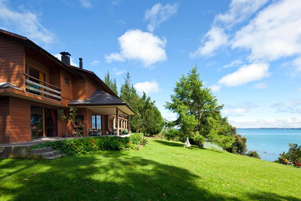
    Las Juntas Ecolodge sits directly in front of Puyehue Lake, just off Route 215. The setting is quiet and green, with open lake views and a large garden. You are close to hot springs and national park access, but far from towns or services.

    The lodge has a small, family run feel and a calm atmosphere. Common areas and outdoor spaces are designed for relaxing rather than activities, making it easy to slow down and enjoy the surroundings.

    Rooms are simple and comfortable, with private bathrooms, heating, and views toward the lake or garden. The style is traditional and functional, with no luxury features but everything needed for a comfortable stay.

    Breakfast is included and served buffet style, with homemade bread, jams, and regional products. In low season, meals need to be ordered in advance, which is important to plan for due to the remote location.

    Las Juntas Ecolodge is a good choice if you want lakefront views, quiet nights, and a personal atmosphere. It suits travelers with a car who plan to explore Puyehue slowly rather than move every day.

    👉 Book Las Juntas Ecolodge

    Hotel Hosteria Entre Lagos

    Puyehue Chile hotel Hotel Hosteria Entre Lagos
    • Area: Central Puyehue, near Lake Puyehue and Route 215
    • Best for: Short stays, border crossings, couples, families
    • Price: $

    Check availability

    Hotel Hosteria Entre Lagos is located in the small town of Entre Lagos, within walking distance of the lake and basic services. The location is practical if you are passing through the area or waiting to cross toward Argentina. Everything is close and easy to reach.

    The hotel has a traditional, small town feel rather than a resort atmosphere. Common areas include a restaurant, bar, and terrace, with views toward the lake and surrounding hills.

    Rooms are clean and comfortable, with private bathrooms, heating, TV, and simple furnishings. Some rooms offer lake or mountain views, and comfort is more important here than design or style.

    An on site restaurant serves breakfast and other meals, which is useful given the limited dining options nearby. Free WiFi and free private parking are available, and there is a 24 hour front desk.

    Hotel Hosteria Entre Lagos is a solid choice for a one night stop or short stay. It works well if you want a central location, easy logistics, and a straightforward place to rest before continuing your trip.

    👉 Book Hotel Hosteria Entre Lagos

    OUTSCAPE l Cabañas a Orilla del Lago Puyehue

    Puyehue Chile hotel OUTSCAPE l Cabañas a Orilla del Lago Puyehue
    • Area: Lakeside Puyehue, directly on Lake Puyehue along Route 215
    • Best for: Couples, quiet cabin stays, scenic short breaks
    • Price: $$

    Check availability

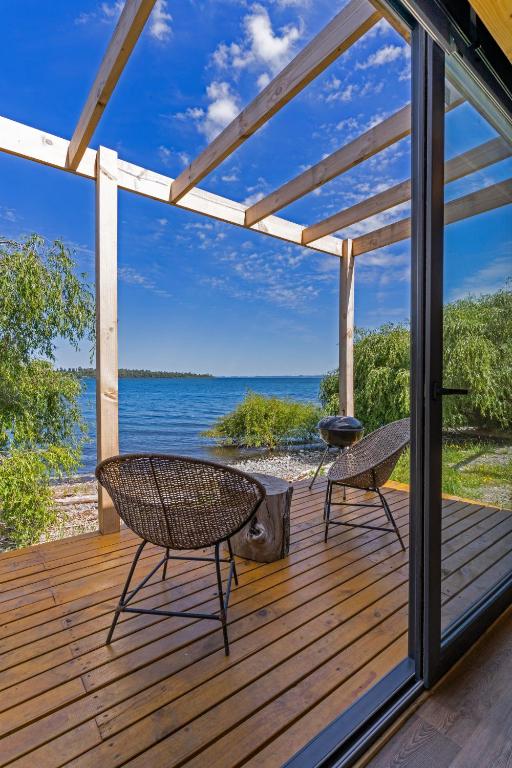
    OUTSCAPE Cabañas a Orilla del Lago Puyehue is set right on the lake shore, a short drive from Puyehue village and the hot springs area. The location feels private and calm, with direct lake access and open water views. This is a place designed for staying in rather than sightseeing all day.

    The cabins are modern and well designed, with large windows and terraces facing the lake. The atmosphere is quiet and uncluttered, with a strong focus on nature, light, and privacy.

    Each cabin includes a private bathroom, air conditioning, and a fully equipped kitchen with a refrigerator, stovetop, microwave, and dining area. The setup works well for self catering and longer stays.

    Outdoor space is a key part of the experience, with terraces and seating areas close to the water. Free private parking is available on site, and check in is simple and low key.

    OUTSCAPE is ideal if you want a peaceful lakeside stay with comfort and independence. It suits couples and travelers who value views, silence, and a slower rhythm near Puyehue.

    👉 Book OUTSCAPE l Cabañas a Orilla del Lago Puyehue